Overview
Bathymetric surveys measure the depth and shape of underwater terrain (rivers, lakes, reservoirs, coastal zones). They support safe navigation, engineering design, environmental monitoring, and asset management. While often grouped under hydrography, bathymetry focuses on the seafloor/bed surface—its elevation and morphology—rather than broader water column or navigational data.
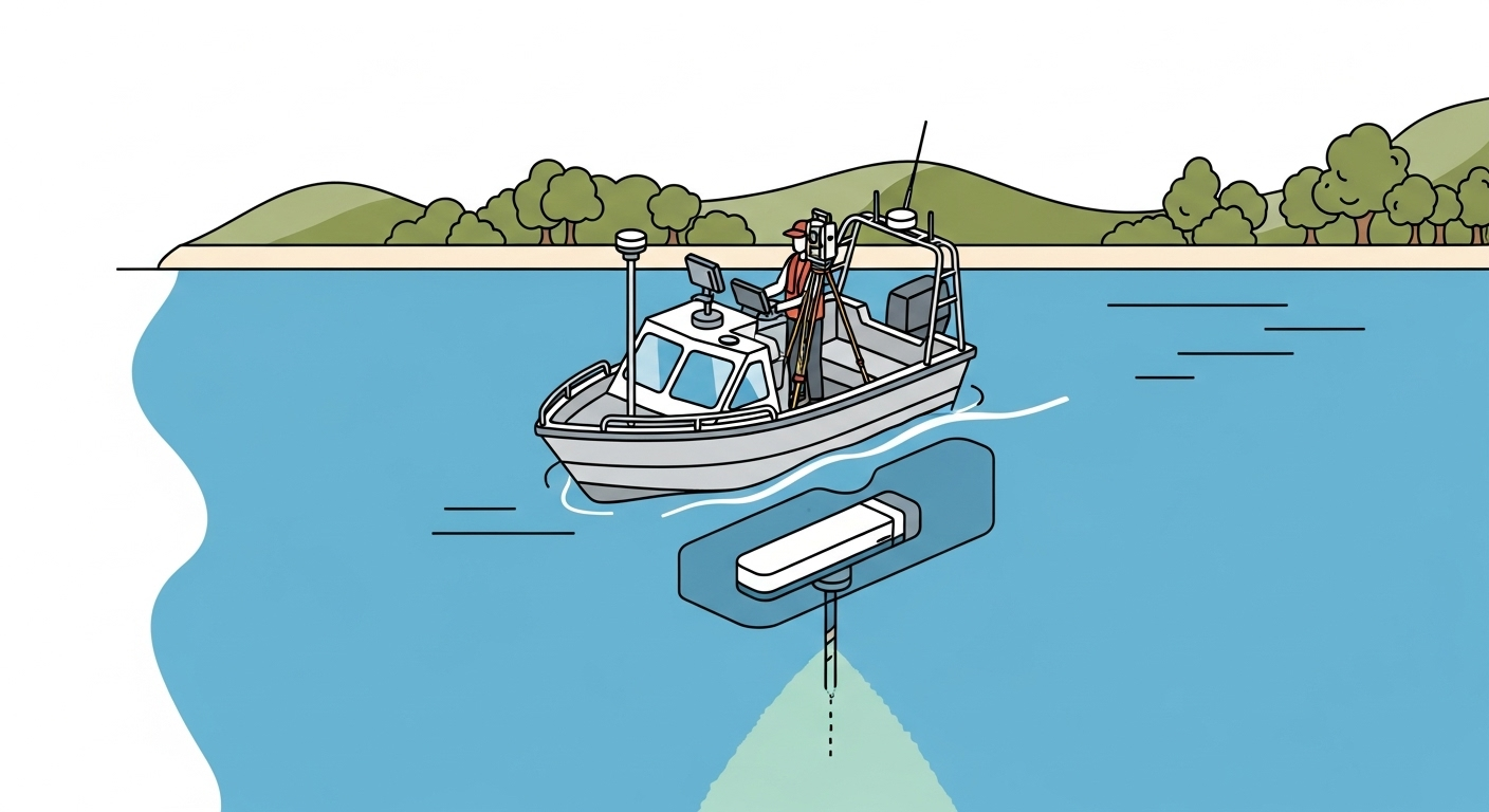
Common Methods & Sensors
- Single-beam echosounder (SBES): Single depth measurements along track; lower cost, suitable for smaller areas or reconnaissance.
- Multibeam echosounder (MBES): Wide swath coverage with dense soundings forming a full-coverage point cloud; ideal for engineering-grade deliverables and change detection.
- Side-scan sonar (SSS): Imaging system that highlights seafloor texture and hazards; often paired with SBES/MBES for interpretation.
- Bathymetric LiDAR (green laser): Airborne method effective in clear, shallow waters; complements vessel-based sonar in surf/nearshore.
- Sub-bottom profiler (SBP): Penetrates below the bed to identify layers or buried objects (not a depth measurement of the bed surface itself).
- ADCP (Acoustic Doppler Current Profiler): Measures water velocity; useful for scour studies and hydraulic modeling.
Supporting sensors: GNSS + inertial/motion (IMU/MRU), sound velocity profilers (SVP) and CTD casts, tide gauges or GNSS tide models. Correct timing and offsets (lever arms), and consistent patch testing are essential for accuracy.
Accuracy, Datums & QA/QC
- Vertical datums: Reduce to chart/tidal datum (e.g., MLLW) or ellipsoidal heights with geoid models; be explicit in metadata.
- Standards: Follow project/client specs; reference hydrographic guidelines (e.g., quality levels and total vertical uncertainty philosophy).
- QA/QC: Perform patch tests, bar checks, run crosslines, and validate sound velocity. Document uncertainty budgets and acceptance thresholds.
Typical Deliverables
- Cleaned soundings (XYZ/CSV) and gridded surfaces (TIN/DTM).
- Contours and cross-sections for design packages.
- Rasters (GeoTIFF) or BAG gridded surfaces.
- CAD/ GIS formats (DXF/DWG, GeoPackage), with coordinate system and vertical datum clearly stated.
Estimation & Planning
- Estimation drivers:
- Depth range, area coverage, and water clarity/conditions.
- Method selection (single-beam, multibeam, bathymetric LiDAR) vs. required resolution/coverage.
- Vertical datum/tide reduction approach and available control/benchmarks.
- Vessel/access logistics, safety constraints, and work windows.
- Sound velocity profiling, calibration/crossline requirements, and QA documentation.
- Deliverables and acceptance criteria driving processing effort.
- Client questions before quoting:
- Required vertical datum and tide/control approach?
- Coverage and resolution requirements; any method preferences or constraints?
- Permits/access windows and site safety requirements?
- Deliverable formats (XYZ, surfaces, contours, rasters) and metadata needs?
- Existing surveys or benchmarks to tie into?
- Known obstructions/hazards and any required coordination (e.g., harbor authority)?
Workflow with Job Book
- Tag each job with this scope so it’s easy to find in search and on the map.
- Use budgets and estimates to plan labor and equipment; compare with similar past jobs.
- Create tasks and assign crews; schedule work to avoid conflicts.
- Link vessels and sensors as assets for availability, usage, and cost tracking.
- Capture field time (DWR/LEM) and timesheets; speed approvals and invoicing.
- Monitor WIP and profitability by scope, client, and region in reporting.
Common Pitfalls & Tips
- Incorrect or undocumented datum/tide reductions; confirm early and document.
- Insufficient crosslines or calibration records; plan and capture evidence.
- Gaps in sound velocity profiling; schedule casts and review consistency.
- Missing metadata on methods, offsets, CRS, and vertical reference; include with deliverables.
Why Tagging This Scope Matters
- Faster estimating: Find previous
Bathymetric Surveyjobs by scope, location, and client to benchmark hours and costs. - Better findability: Use search and maps to pull up past work, contacts, and job details quickly.
- Clear profitability: See WIP and profitability by scope, client, and region.
- Fewer delays: Capture time and approvals in the field to invoice sooner.
- Coordinated delivery: Assign tasks and crews; link assets to avoid conflicts.